Cascading Concerns over Waterways: A closer look at the Springs, Streams and Rivers of Western and Eastern Himalaya in Anthropocene
Groundwater-fed springs scattered throughout the mountainous landscapes of the Indian Himalayas serve as the primary source for local rural and urban water supplies. Yet in recent decades, spanning the past four to five years, emerging reports indicate declining water availability from springs and streams across the Himalayan middle mountain regions. This widespread phenomenon stems from a complex interplay of evolving biophysical and socioeconomic factors. The understanding of the underlying processes leading to such a widespread lean period scarcity is addressed through long-term research, monitoring and with sound instrumentation from catchment based investigation. Attempt to advance the knowledge of hydrological responses in Lesser Himalayan headwater springs and streams via multi-tracer analysis of stable isotopes, conductivity, and temperature was made.Detialed geological mapping, stable isotope application assisted in developing a deeper understanding aquifer characteristics, rainfall-recharge volume and approximate recharge elevation of the springs and low-order streams in the headwaters.
The recession characteristics of spring discharge reveals that the supporting groundwater aquifer system is extremely sensitive to storage modifications, primarily influenced by preceding storage conditions that depend on monsoon rainfall quantity and distribution. Compared to the first half of the 20th century, the period from 1961–2018 shows reduced annual and seasonal precipitation accompanied by more frequent moderate to severe droughts. The IMD gridded dataset reveals an abrupt transition to this declining pattern during the early to mid-1960s in the long term trend analysis result. Managing water in the 21st century in the heterogeneous sloping landscape can be addressed through either storage of surplus water or simple runoff storage in the hydrologically sensitive areas (HSA) through appropriate soil and water conservation measures which can buffer the impact from vagaries of rainfall uncertainty. Source area protection and storage are the two key measures for long-term water resource sustainability.
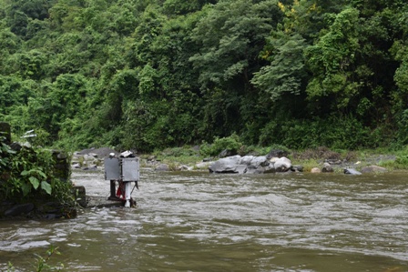
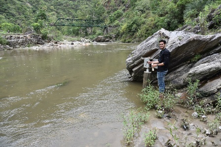
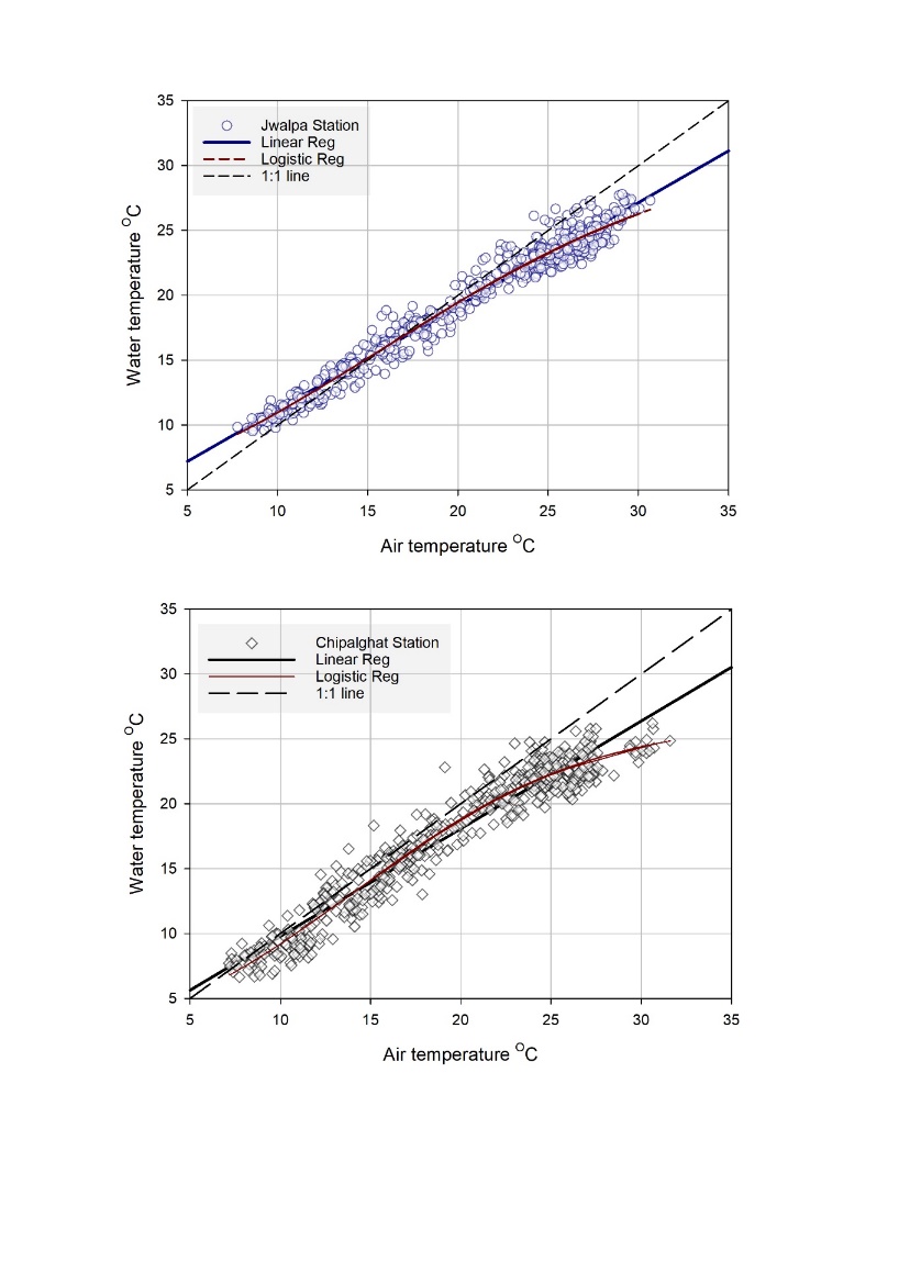
Historical trends in recent decades from the long-term records of river temperature from all across the world points towards increasing river and stream water temperature. The basins from Himalayan mountains are witnessing similar threats cause by observed declining trends in rainfall, rising temperature ,increase in lowflows, depletion in snow cover area (SCA) , net loss in the state of glaciers mass/area bringing changes in the hydrological functioning. Lack of continuous monitoring stations across the major basins in Indian Himalaya limits our assessment in terms of understanding of the magnitude of the problem from a local to regional perspective. To assess the vulnerability of the riverine ecosystem, network of six to seven monitoring stations were established along the river system, extending from the headwater regions downstream till the confluence of the Nayar River to the Ganga River. These stations were equipped with instruments (Photograph) to continuously measure both Air Temperature (AT) and Water Temperature (WT). This longitudinal arrangement of field-based monitoring sites was designed to assess the thermal sensitivity of the river network. The results highlight that the Nayar River and its headwater tributaries exhibit a strong air-coupled thermal signature, making the entire riverine ecosystem highly vulnerable to climate change impacts. In contrast, the Ganga River displayed a narrower temperature fluctuation range (c. 5.34 oC), indicating an altered thermal regime due to the regulated flows from reservoirs on the Bhagirathi and Alaknanda Rivers.